Atlas Minor
Jan Jansson (the younger) had a new set of plates engraved in 1628 by Abraham Goos and Pieter van den Keere for his Atlas Minor Gerardi Mercatoris a J. Hondio ... auctus et illustratus: denuo recognitus, additique novus delineationibus emendates. The plates are similar size to the Hondius 1607 ones, but the sea is blank instead of shaded and the writing is plain italic instead of Hondius's cursive with flourishes.
These new plates were reduced size copies of Mercator's 1595 plates of his Atlas sive Cosmographicae; being smaller there is less detail, but the same full list of county names in a similar cartouche.
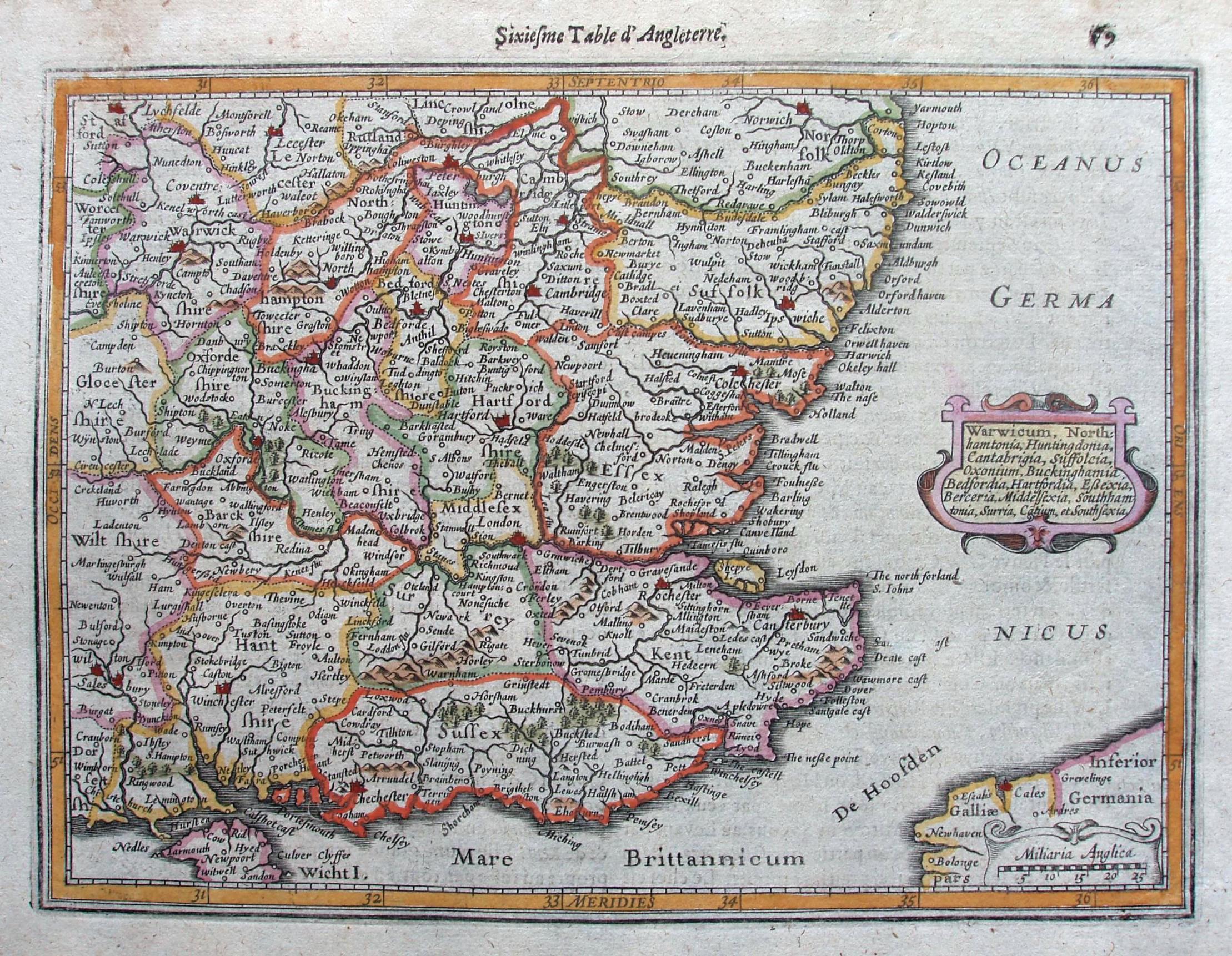
Eastern England appears on page 79, entitled Warwicum, Northhamtonia, Huntingdonia, Cantabrigia, Suffolcia, Oxonium, Buckinghamia, Bedfordia, Hartfordia, Essexia, Berceria, Middelsexia, Southhatonia, Surria, Cantii & Southsexia, with three pages of text. The county names are in an ornamental cartouche in the North Sea, similar in style to the 1595 Atlas, but far smaller and far less ornate.
The seas are unadorned and have horizontal shading on the sea
side of coast of only medium density, which obscures no names. There is Oceanus Germanicus in the North Sea, Mare Brittannicum in the Channel, and De Hoosden between Dover & Calais. Many places are named (eg Walden and Newport), giving a very crowded appearance. London is at longitude 32o45' east, and there is a scale of Miliaria Anglica 25 = 26mm, or 24.4 mls/inch; actual scale is 27.4 mls/inch, or 1:1,735,000 - his "mile" is thus about 1.12 statute miles. (The Prime Meridian for this appears to be the easternmost edge of South America - ?)
Jansson's Atlas Minor was printed in 9 editions of from 1628 to 1651 (3 Latin, 2 French, 3 German, 1 Dutch). Initially the only British maps were of regions, as shown here, but in the German 1651 edition 8 individual English counties were added (& other maps), all after Speed with plates by P van den Keere. This map is the 6th (regional) map of England ("Sixieme Table d'Angleterre") from the 1633 French edition.
Displayed scale of 25 Miliaria Anglia = 26mm, ie 24.4 miles/inch; scale actual = 27.4 miles/inch, or 1:1,735,000; his "mile" is about 1.12 statute miles.