Dugdale's England & Wales Delineated, Curiosities of Great Britain
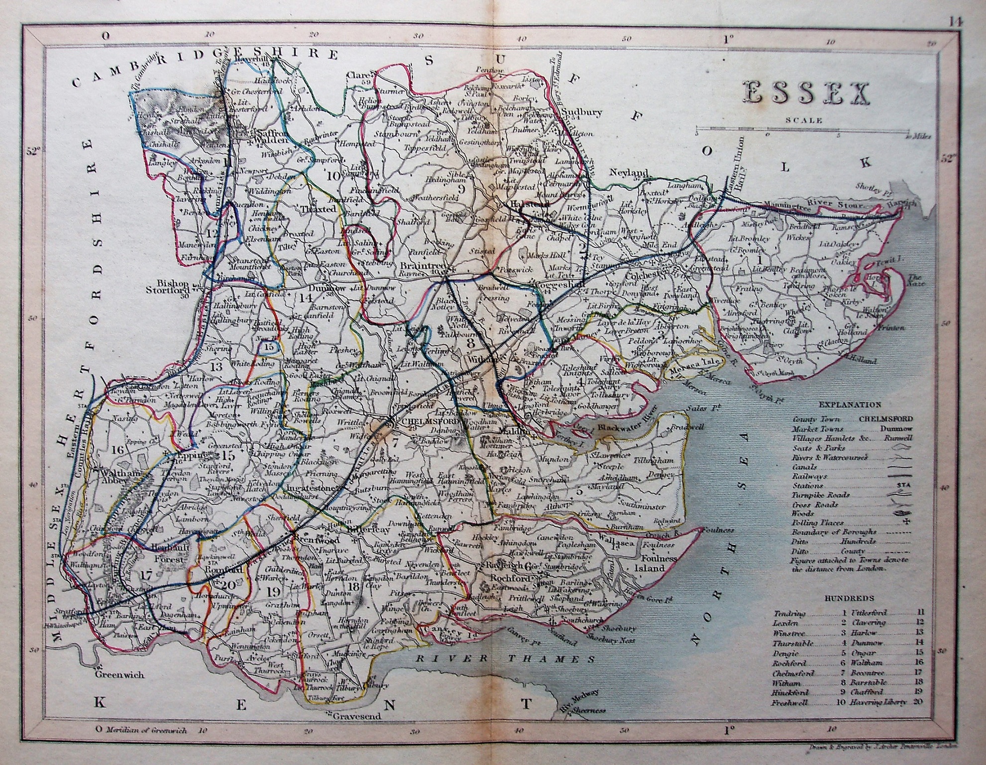
Dugdale's England & Wales Delineated, Curiosities of Great Britain used Cole & Roper 1810 maps in its 1835 edition, but in 1842/43 and later it uses maps by J Archer. There is Archer's imprint in the bottom right and a small 14 in the top right, but no Dugdale imprint across the base - making this the late 1840's edition.
The boundaries of the Hundreds are coloured, but in a pretty loose, not to say careless, manner.
Scale correct at 15 miles = 53mm, or 7.15 miles/inch, ie 1:450,000.
The railways shown are a bit of a puzzle: it has the Marks Tey to Sudbury (authorised 1846; opened 1849), the Ilford to Ray House to Epping line (auth'd 1846 but never built), the Braintree to Witham to Maldon line (auth'd 1846, opened 1848) and the Manningtree to Harwich (auth'd 1847, opened 1854). It also has a line from Stratford to Tilbury Fort line (should be to North Woolwich). There is the Thameshaven line (auth'd 1836 but never built - cancelled 1856), abut at least it doesn't have the very odd North Ockendon to Tilbury Fort line (never built, or authorised). From all these contradictions I estimate a date of 1847. See also Archer's "1846" map.