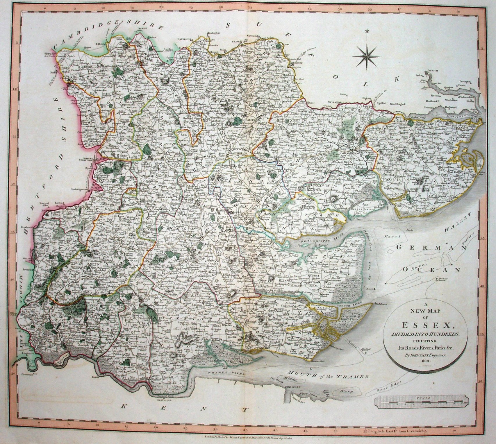
New English Atlas
The New Map of Essex was created in 1801 as we can see from the plate, but the New English Atlas was not published until 1809; it was re-published many times up to 1842.
Longitude shown from Greenwich, the joint first Essex county map to do so (with Smith), but the Cary's was in his 1809 Atlas whereas Smith's was in his 1804 Atlas - and hence Smith gets the prize. Both Smith's Essex and Cary's Essex are dated 1801. Further "firsts" concerning the longitudes are on the Meridians page.
Scale correct at 10 miles = 92.2mm, or 2.8 miles/inch, ie 1:175,000.
The Cary maps were later sold to Cruchley who added railways progressively and used them in his Railway & Telegraphic County Atlas of England and Wales, which was published from 1857 to 1888.