- Home
- Introduction
- Mapmakers
- County Maps
- Map publishers
- Road Maps
- Dealers
- Libs & Socs
- Cartobibliogs
- Books
- Dating maps
- Parliamentary
- Railways
- Sundry
- Revisions
Almost every map has a representative scale, which for county maps generally take the form of a scale bar with tick marks to show miles. Measuring the scale bar against the number of miles gives a result such as 82.5 mm = 13 miles, meaning a scale of 1:253,594 or 4.0 miles to the inch. BUT, that is the displayed scale, which of course may or may not be accurate.
There are more than one reason why this could be wrong - the simple one being error on the part of some link in the chain of surveyor -> drawer -> engraver. The other reason is that the map may be using a mile different from the standard statute mile of 1,760 yards.
The statute mile was defined by an Elizabethan law in 1593, but it was generally ignored everywhere in England outside Westminster. The term "mile" was used throughout England, but there were many local definitions, generally longer (ie more than 1,760 yards). Sometimes it was 10 furlongs (ie 2,200 yards) or even 12 furlongs (2,640 yards), but in many places it seems to have been just whatever they fancied.
The discrepancies around the country were well known to cartographers (even if they usually drew a veil over it), such that John Morden went as far as showing multiple scales, for "Great", "Middle" and "Small" miles:
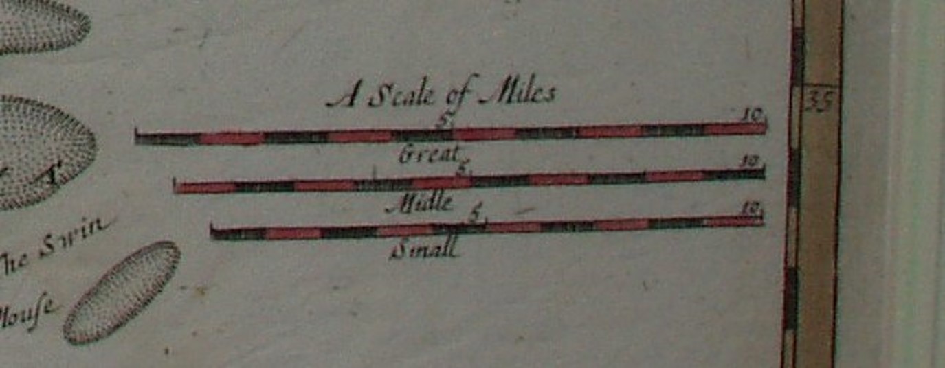
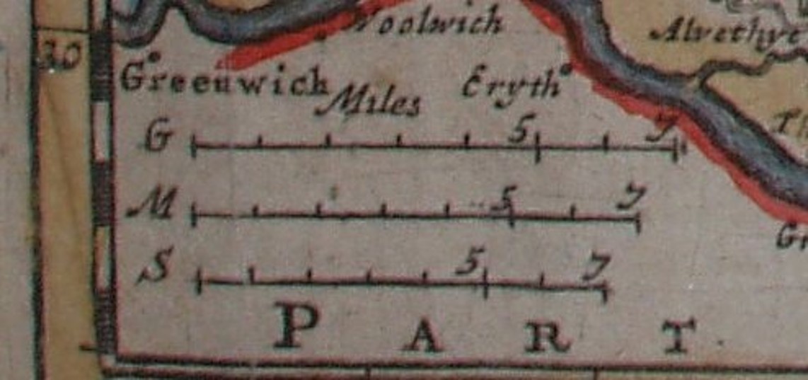
The 1695 "Small" (left picture) is about equal to a statute mile, whereas on the 1701 map (right picture) a statute mile is between the "Middle" and "Small" miles.
Another issue facing early cartographers was just how many miles are there in a degree of latitude - if you are establishing latitudes (& longitudes) from astronomical obersevations for places and then calculating distances based on there being 60 miles to a degree of latitude you will underestimate distances: there are actually about 69 (statute) miles to a degree of latitude in Britain (it varies from equator to poles because of the earth being a slightly squashed sphere). Unfortunately it was believed to be 60 miles to a degree until the mid-eighteenth century, so all maps before then - if they use astronomical sightings to derive distances - will be about 13% under-stated.
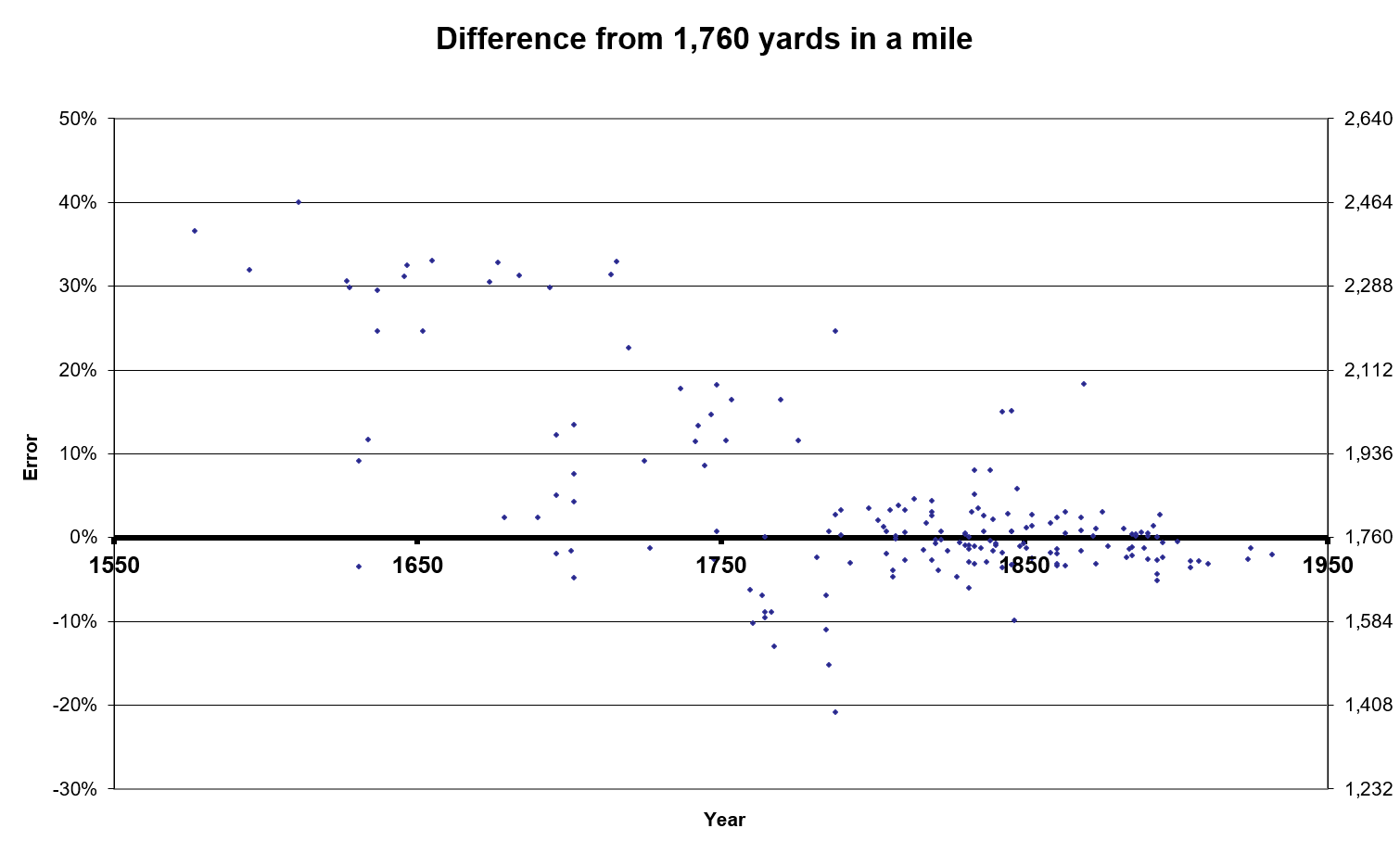
I can calculate the true scale of a printed map by measuring the distance from where the river Lea enters the Thames to the tip of the Harwich peninsula (which is actually 100.5 Kms). If I then compare this against the displayed scale (ie based on the Scale Bar) I can work out by how much their displayed scale of miles differs from using accurate Statute Miles: this portrayed for some of my maps as a graph across the years gives:
Return to the page of various topics.