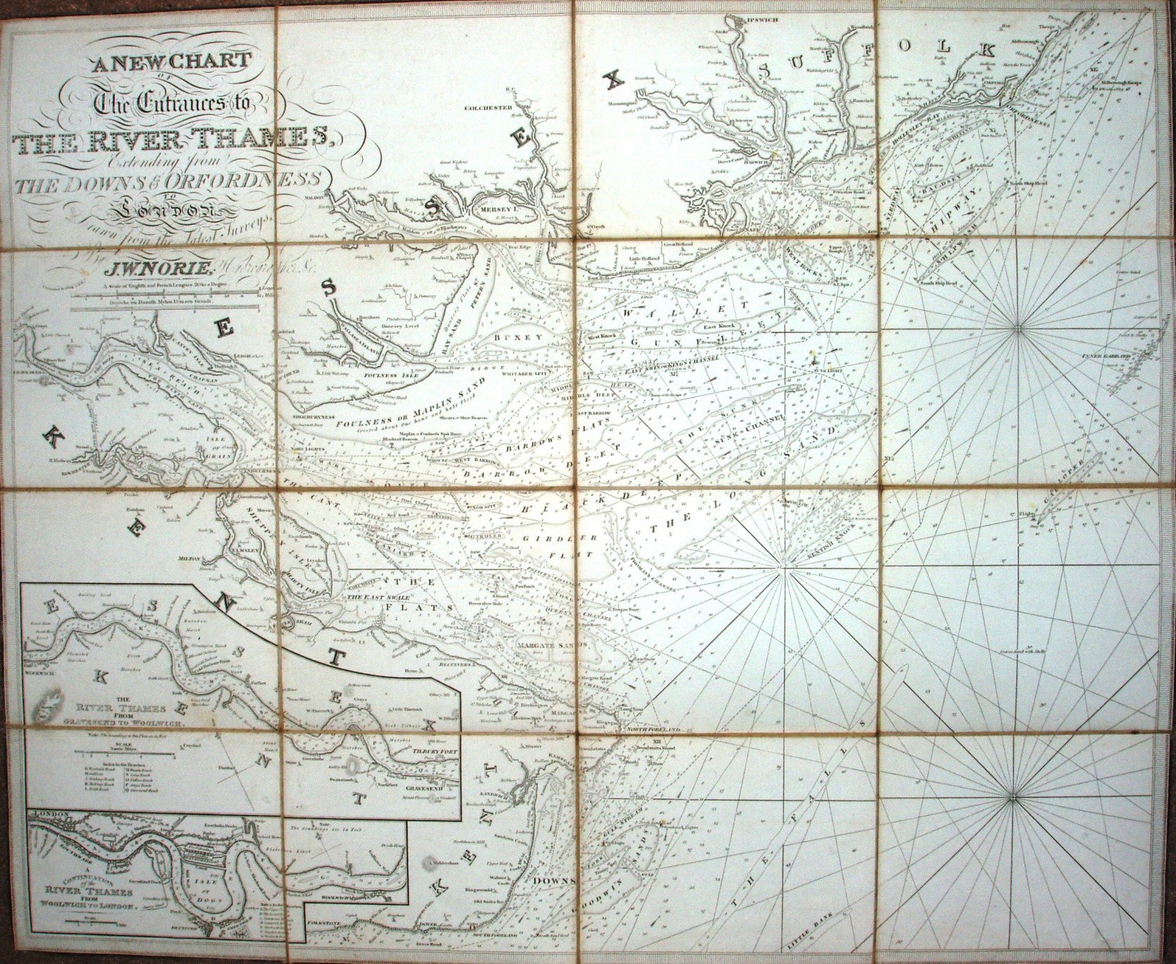
A New Chart of the Entrances to the Thames
Dissected on cloth. Detailed coastal map with depths, shoals, etc, from Kent to Suffolk.
It shows sandbanks and spot depths, but surely too ornate to have ever been used for navigation.
A scale of English and French Leagues 20 to a degree, 12mls = 132mm. Displayed 2.3ml/in