Emanuel Bowen was born in Wales, but had moved to London by 1709. He engraved many maps for many publishers before (and whilst) publishing his own atlases. He took Thomas Kitchin as an apprentice in 1732, and who then married his daughter in 1739. He died in 1767, "reduced by family extravagance, and almost blind through age" (Richard Gough, quoted by Worms and Baynton-Williams).
Thomas Bowen was a son of Emanuel, being apprenticed to him in 1748. He also engraved maps for many publishers (many the same as his father), but spent some time insolvent, and died in Clarkenwell Workhouse.
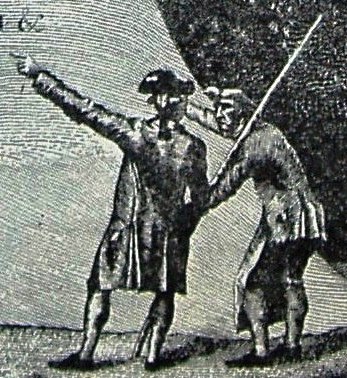
They shared with Kitchin a standard compass rose symbol on all (?) of their maps; the existence of this symbol on a map will strongly indicate that it is a Kitchin and/or Bowens production.
They produced alone or with others many individual county maps and county atlases, as well as individual (newly surveyed) counties and overseas locations. The county maps are (mainly) based on the (surveyed) map by Warburton - originally published in 1724, so not particularly up to date, although probably little was changing across Essex at the scales they created maps. The maps of Essex they created are listed below, together with examples:
| Links to examples | Notes |
|---|---|
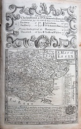
Britannia Depicta, or Ogilby Improv'd, was published in 1720, the year after the Gardner and Senex road books, but was far more successful. It had the same strip maps based on Ogilby, but also had county maps and information on towns. It was republished many times. 178mm x 191mm. No Latitude, Longitude or grid. Scale of 15mls = 29.2mm, ie a displayed scale of 13.1ml/in; actual scale = 15.4ml/in, or 1:975,000. |
|
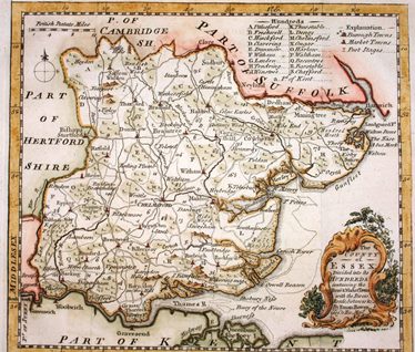
The Universal Magazine was published monthly from 1747 until 1799, published by John Hinton until his death in 1781. County maps were published from June 1747 until September 1766 (drawn by Emanuel Bowen or Thomas Kitchin), and then a completely different set from 1791 to 1798. Essex was published in January 1750, drawn by Thomas Kitchin (who was officially working for the London Magazine by then). 178mm x 191mm. Scale correct at 10mls = 30.5mm, or 8.2 miles/inch, ie 1:515,000. |
|
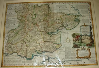
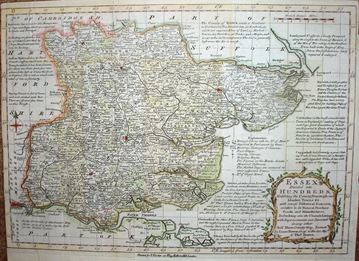
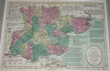
The Large English Atlas was led by Emanuel Bowen, with Kitchin as one of his workers on the individual map (Essex being created in 1749). The Atlas's maps seem to have been based on the latest surveyed maps of each county, which in the case of Essex was the Warburton of 1724. The complete Atlas was published 1760. Displayed scale of 15mls = 137.5mm, or 2.8 miles/inch; actual scale = 2.5 miles/inch, or 1:158,000. |
|
The maps are based on Bowen's Large English Atlas series which had been published individually up to this date. The maps were first published in The General Magazine (Essex in March 1759), and then in the two volume Natural History of England published in 1759 & 1763 (Essex is in volume 2). The Natural History & the individual plates were never reprinted, but were closely copied by Meijer in 1763. Displayed scale of 12 miles = 32.7mm, or 9.3 miles/inch; actual scale = 8.8 miles/inch, or 1:555,000. |
|
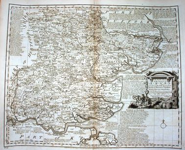
The Royal English Atlas was published in 1764, derived from the Large English Atlas; it is two-thirds the size of the LEA, and at two thirds the price - 2 guineas as opposed to 3 guineas. There are some suggestions that this was also published by Kitchin as the English Atlas in 1765 (although this may be a mis-association with the atlas of that name which was published later, being a reprint of the Royal English Atlas). Scale correct at 12 miles = 90mm, or 3.4 miles/inch, ie 1:215,000. |
|
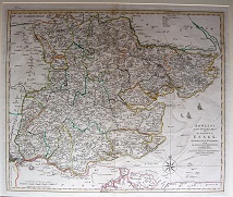
The Bowens (E & T) had published Atlas Anglicanus in 1767, a reduced version of the earlier Royal English Atlas and uses abbreviated versions of those notes around the map. (The latter Atlas was itself a reduced verion of the Large English Atlas). This was first published as a part work from 1767 to 1768, and then as an atlas in 1768. This is the 2nd edition of 1777, as does not have an "8" in the top right corner, and has Thomas Kitchin's name across the bottom. The maps were used again by Bowles in 1785. Displayed scale of 14 miles = 53mm, or 6.7 miles/inch; actual scale = 5.9 miles/inch, or 1:370,000. |
|
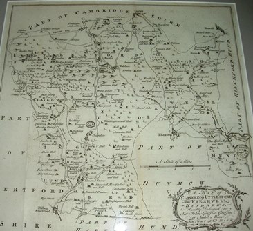
Emanuel Bowen then used the Atlas Anglicanus county map in Morant's History of Essex, published in 1768. To that he added eight regional maps within Essex, each showing two or more of the Hundreds. xxx. Displayed scale of 4 miles = 77mm, ie about one inch = 1.3 miles (1:84,000). |
|
This is a 1781 variant version of Bowen & Kitchin's Royal English Atlas published in 1764. Given the latter can trace its information back to a 1749 map calling it "new" does seem to stretch the truth. Scale correct at 10 miles = 83.5mm, or 3.0 miles/inch, ie 1:190,000. |
|
This is essentially the Atlas Anglicanus plates from 1767 with a deleted old cartouche and a new one concerning Bowles inserted. It was republished in 1793+ with apparently a few more minor changes. Displayed scale of 14 miles = 53mm, or 6.7 miles/inch, actual scale = 5.7 miles/inch, ie 1:360,000. |
Return to the Map publishers main page.